Loading... Please wait...


- Home
- Camp, Hike & Survive
- Navigation
- Maps
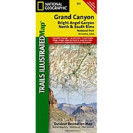
- National Geographic Map - Grand Canyon Bright Angel Canyon North & South Rims 261


National Geographic Map - Grand Canyon Bright Angel Canyon North & South Rims 261

Product Description
Coverage highlights: Colorado River miles 60-98, North and South Rim visitor centers, Grand Canyon Village, Grand Canyon / National Geographic IMAX, Tusayan, Grand Canyon Railroad Station, Bright Angel Trail (plus elevation profile), West Rim Trail, Kaibab Trail, Arizona Trail, Grand Canyon Lodge, and more.
The map also includes Wilderness Safety tips, land use regulations, and information on how best to react to bear encounters. Beautiful cartography shows the mountains, rivers, marsh areas, and natural features of this spectacular land. UTM tick marks for use with your GPS unit are also provided.
This map replaces the previous Grand Canyon National Park Trail Map (#207). Completely redesigned and updated, the map provides an enhanced scale and detail for the highest visitation area of the park surrounding the Grand Canyon South Rim Visitor Center and the Bright Angel Trail.
- Approximately 4 1/4" x 9 1/4" folded; 27" x 39" fully opened
- Scale = 1:35,000
- Map revised - 2000
Product Reviews
Recently Viewed Items: