Loading... Please wait...


- Home
- Camp, Hike & Survive
- Navigation
- Maps
- National Geographic Map - Appalachian Trail - Swatara Gap to Delaware Water Gap


National Geographic Map - Appalachian Trail - Swatara Gap to Delaware Water Gap

Product Description
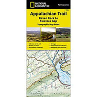
Appalachian Trail - Swatara Gap to Delaware Water Gap
The Swatara Gap to Delaware Water Gap Topographic Map Guide makes a perfect traveling companion when traversing the northeastern Pennsylvania section of the Appalachian Trail (A.T.). The trail in this section of Pennsylvania primarily travels across flat, rocky ridges mixed with strenuous climbs in and out of various gaps. Between Swatara Gap and Wind Gap, the A.T. weaves in and out of Pennsylvania State Game Lands as it follows the long ridge of Blue Mountain. From Wind Gap north, the A.T. follows the ridge of Kittatinny Mountain on its way to the Delaware Water Gap.
Each A.T. Topographic Map Guide includes detailed topographic maps at a detail of 1 inch = 1 mile. Each page is centered on the A.T. and overlaps with the adjacent pages so there is little chance of getting lost. Along the bottom of each page is a trail profile that shows the distance between shelters, camping areas, and trail access points. The map and trail profile provide a step by step visual guide to hiking the trail, mile by rugged mile. The Topographic Map Guide is built for all levels of hiking enthusiasts, from the day tripper to the multi-month 'thru-hiker'. The front pages include resupply information, town inset maps, camping options, and much more.
Other features found on this map include: 501 Shelter, Allentown Shelter, Bake Oven Knob Shelter, Delaware Water Gap, Eagles Nest Shelter, Eckville Shelter, George W. Outerbridge Shelter, Hamburg, Kirkridge Shelter, Lehigh River, Leroy A. Smith Shelter, Palmerton, Port Clinton, Stroudsburg, Sunfish Pond, Swatara Gap, Swatara State Park, The Pinnacle, William Penn Shelter, Wind Gap, Windsor Furnace Shelter, Worthington State Forest.
- Waterproof and tear-resistant.
- Clearly marked trails for hiking, biking, horseback riding, ATV, and more.
- Detailed topography and clearly defined, color-coded boundaries of state parks, national recreation areas, wilderness areas, marine sanctuaries, and wildlife refuges.
- Hundreds of points of interest, including scenic viewpoints, campgrounds, boat launches, swimming areas, fishing access points, and more.
- UTM and latitude/longitude grid, as well as selected waypoints and a scale bar for easy and accurate navigation.
- Detailed road network.
- Important safety information and travel tips.
Product Reviews
Recently Viewed Items: