Loading... Please wait...


- Home
- Camp, Hike & Survive
- Navigation
- Maps
- National Geographic Map - Appalachian Trail - Schaghticoke Mountain to East Mountain


National Geographic Map - Appalachian Trail - Schaghticoke Mountain to East Mountain

Product Description
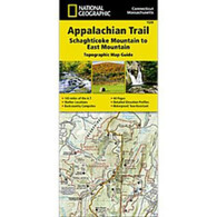
Appalachian Trail - Schaghticoke Mountain to East Mountain
The Schaghticoke Mountain to East Mountain Topographic Map Guide makes a perfect traveling companion when traversing the Connecticut and Massachusetts sections of the Appalachian Trail (A.T.). The trail in this section of New England skirts the northwest corner of Connecticut and traverses what remains of a once mighty mountain range. The hiking is moderate through Connecticut and the climbs are short, but can be steep. As the trail crosses into Massachusetts, it enters the Berkshires, characterized by wooded hills and outstanding views with pleasant, flat hiking along the Berkshire plateau.
Each A.T. Topographic Map Guide includes detailed topographic maps at a detail of 1 inch = 1 mile. Each page is centered on the A.T. and overlaps with the adjacent pages so there is little chance of getting lost. Along the bottom of each page is a trail profile that shows the distance between shelters, camping areas, and trail access points. The map and trail profile provide a step by step visual guide to hiking the trail, mile by rugged mile. The Topographic Map Guide is built for all levels of hiking enthusiasts, from the day tripper to the multi-month 'thru-hiker'. The front pages include resupply information, town inset maps, camping options, and much more.
Other features found on this map include: Bear Mountain, Beartown State Forest, Brassie Brook Shelter, Cheshire, Clarksburg State Forest, Cornwall Bridge, Dalton, East Mountain State Forest, Falls Village, Glen Brook Shelter, Great Barrington, Housatonic State Forest, Kay Wood Shelter, Kent, Lee, Limestone Spring Seth Warner Shelter, Mark Noepel Shelter, Mount Algo Shelter, Mount Greylock State Reservation, Mount Everett, Mount Greylock, Mount Wilcox North Shelter, Mount Wilcox South Shelter, North Adams, October Mountain State Forest, October Mountain Shelter, Pine Swamp Brook Shelter, Pittsfield, Rand’s View, Riga Shelter, Stewart Hollow Brook Shelter, Ten Mile River Shelter, The Hemlocks Shelter, Tom Leonard Shelter, Tyringham, Wilbur Clearing Shelter, Wiley Shelter.
- Waterproof and tear-resistant.
- Clearly marked trails for hiking, biking, horseback riding, ATV, and more.
- Detailed topography and clearly defined, color-coded boundaries of state parks, national recreation areas, wilderness areas, marine sanctuaries, and wildlife refuges.
- Hundreds of points of interest, including scenic viewpoints, campgrounds, boat launches, swimming areas, fishing access points, and more.
- UTM and latitude/longitude grid, as well as selected waypoints and a scale bar for easy and accurate navigation.
- Detailed road network.
- Important safety information and travel tips.
Product Reviews
Recently Viewed Items: