Loading... Please wait...


- Home
- Camp, Hike & Survive
- Navigation
- Maps
- National Geographic Map - Appalachian Trail - Pleasant Pond to Katahdin


National Geographic Map - Appalachian Trail - Pleasant Pond to Katahdin

Product Description
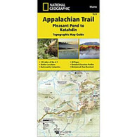
Appalachian Trail - Pleasant Pond to Katahdin
The Pleasant Pond to Katahdin Topographic Map Guide makes a perfect traveling companion when traversing the northern Maine section of the Appalachian Trail (A.T.). The A.T. through Maine offers some of the most challenging sections of trail along the A.T., both in rugged terrain and weather conditions, and is not recommended for the unprepared hiker. Katahdin in Baxter State Park marks the A.T.'s northern terminus and for many hikers it also marks the end of a months long journey.
Each A.T. Topographic Map Guide includes detailed topographic maps at a detail of 1 inch = 1 mile. Each page is centered on the A.T. and overlaps with the adjacent pages so there is little chance of getting lost. Along the bottom of each page is a trail profile that shows the distance between shelters, camping areas, and trail access points. The map and trail profile provide a step by step visual guide to hiking the trail, mile by rugged mile. The Topographic Map Guide is built for all levels of hiking enthusiasts, from the day tripper to the multi-month 'thru-hiker'. The front pages include resupply information, town inset maps, camping options, and much more.
Other features found on this map include: Bald Mountain Brook Shelter, Barren Mountain, Baxter State Park, Carl A. Newhall Shelter, Chairback Gap Shelter, Chairback Mountain, Cloud Pond Shelter, Cooper Brook Falls Shelter, East Branch Shelter, Greenville, Horseshoe Canyon Shelter, Hurd Brook Shelter, Katahdin, Katahdin Stream and The Birches Shelter, Leeman Brook Shelter, Logan Brook Shelter, Long Pond Stream Shelter, Monson, Moxie Bald Shelter, Pleasant Pond Shelter, Potaywadjo Spring Shelter, Rainbow Stream Shelter, Wadleigh Stream Shelter, White Cap Mountain, Wilson Valley Shelter.Waterproof and tear-resistant.
- Clearly marked trails for hiking, biking, horseback riding, ATV, and more.
- Detailed topography and clearly defined, color-coded boundaries of state parks, national recreation areas, wilderness areas, marine sanctuaries, and wildlife refuges.
- Hundreds of points of interest, including scenic viewpoints, campgrounds, boat launches, swimming areas, fishing access points, and more.
- UTM and latitude/longitude grid, as well as selected waypoints and a scale bar for easy and accurate navigation.
- Detailed road network.
- Important safety information and travel tips.
Product Reviews
Recently Viewed Items: