Loading... Please wait...


- Home
- Camp, Hike & Survive
- Navigation
- Maps
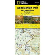
- National Geographic Map - Appalachian Trail - East Mountain to Hanover


National Geographic Map - Appalachian Trail - East Mountain to Hanover

Product Description
Appalachian Trail - East Mountain to Hanover
The East Mountain to Hanover Topographic Map Guide makes a perfect traveling companion when traversing the Vermont section of the Appalachian Trail (A.T.). The landscape of Vermont is a variety of wooded mountains, forests of white pine and paper birch, and rolling terrain dotted by fields and pastures. To the north and east, the A.T. crosses short, steep hills and overgrown farmlands that characterize the Connecticut River valley. Farther south is the rugged and rocky high country of the Green Mountains.
Each A.T. Topographic Map Guide includes detailed topographic maps at a detail of 1 inch = 1 mile. Each page is centered on the A.T. and overlaps with the adjacent pages so there is little chance of getting lost. Along the bottom of each page is a trail profile that shows the distance between shelters, camping areas, and trail access points. The map and trail profile provide a step by step visual guide to hiking the trail, mile by rugged mile. The Topographic Map Guide is built for all levels of hiking enthusiasts, from the day tripper to the multi-month 'thru-hiker'. The front pages include resupply information, town inset maps, camping options, and much more.
Other features found on this map include: Bennington, Big Branch Shelter, Bromley Mountain, Bromley Shelter, Churchill Scott Shelter, Clarendon Shelter, Clarksburg State Forest, Congdon Shelter, Cooper Lodge Shelter, Glastenbury Mountain, Goddard Shelter, Governor Clement Shelter, Green Mountain National Forest, Greenwall Shelter, Hanover, Happy Hill Shelter, Kid Gore Shelter, Killington Peak, Lebanon, Little Rock Pond Shelter, Lost Pond Shelter, Manchester Center, Melville Nauheim Shelter, Minerva Hinchey Shelter, North Adams, Norwich, Peru Peak Shelter, Pico Camp Shelter, Rutland, Seth Warner Shelter, Spruce Peak Shelter, Stony Brook Shelter, Story Spring Shelter, Stratton Mountain, Stratton Pond Shelter, Thistle Hill Shelter, Velvet Rocks Shelter, Wallingford, White River Junction, William B. Douglas Shelter, Winturri Shelter, Woodstock.
- Waterproof and tear-resistant.
- Clearly marked trails for hiking, biking, horseback riding, ATV, and more.
- Detailed topography and clearly defined, color-coded boundaries of state parks, national recreation areas, wilderness areas, marine sanctuaries, and wildlife refuges.
- Hundreds of points of interest, including scenic viewpoints, campgrounds, boat launches, swimming areas, fishing access points, and more.
- UTM and latitude/longitude grid, as well as selected waypoints and a scale bar for easy and accurate navigation.
- Detailed road network.
- Important safety information and travel tips.
Product Reviews
Recently Viewed Items: